

ATC Vectors
Draw the path. Read the wind. Land them on the runway that just lit up. Run a real airport's tower until the sky gets too busy to hold.
For everyone. Now on the App Store and Google Play.


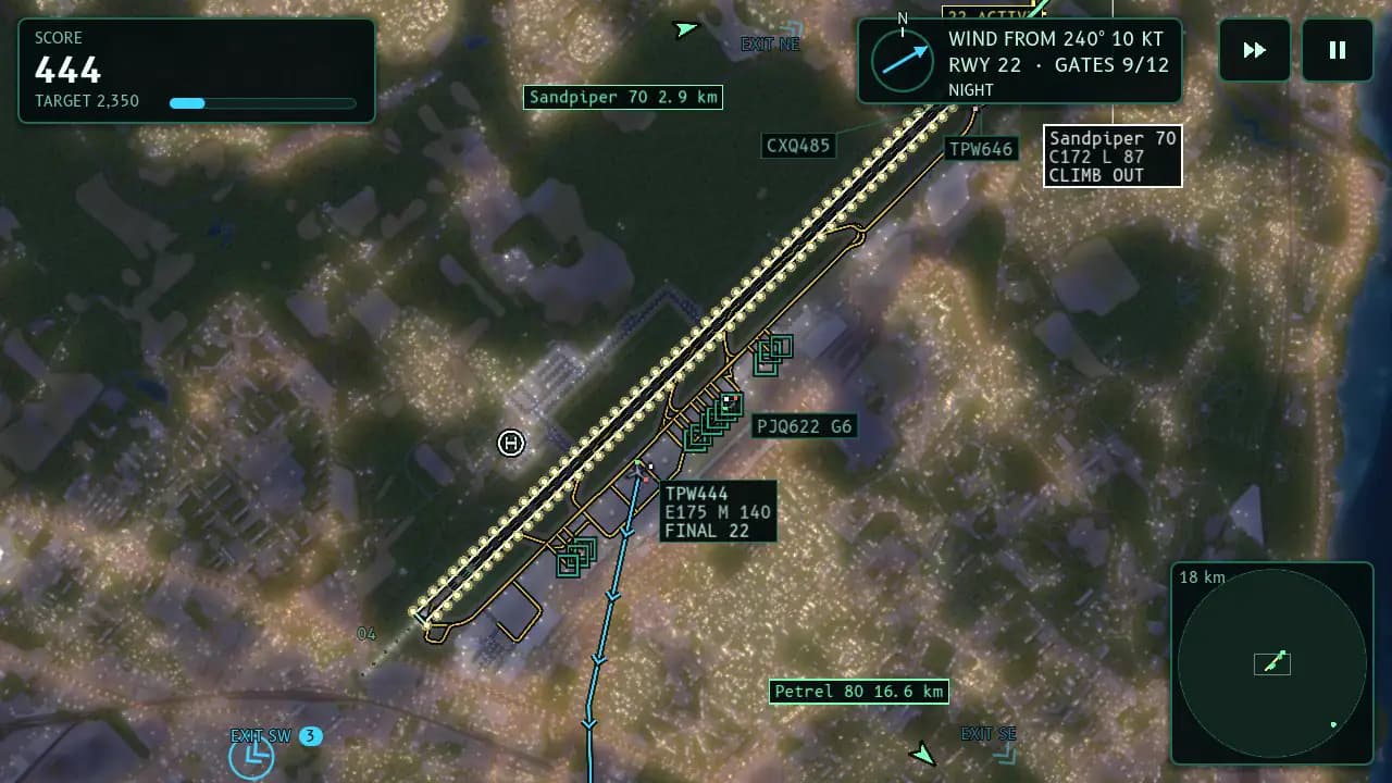
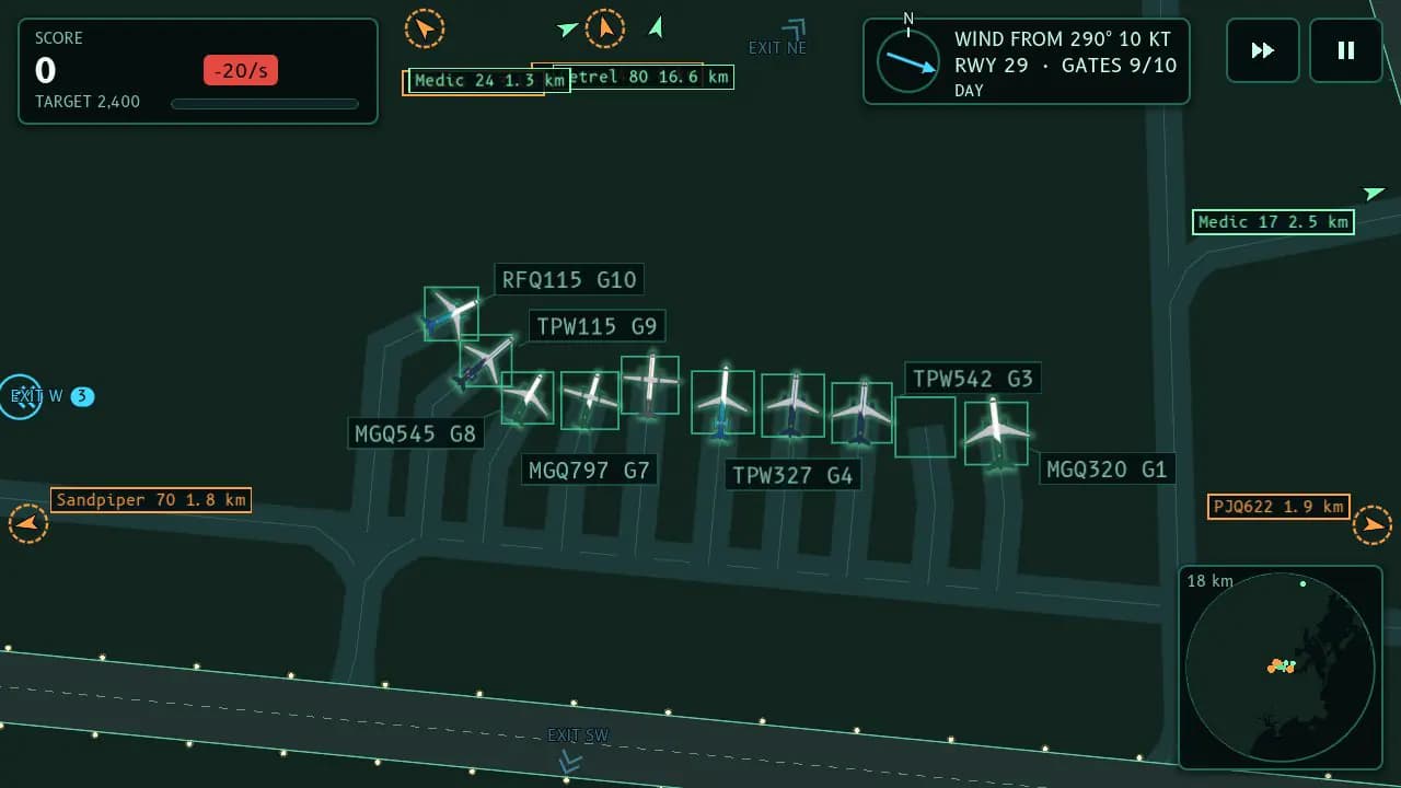
You're the tower
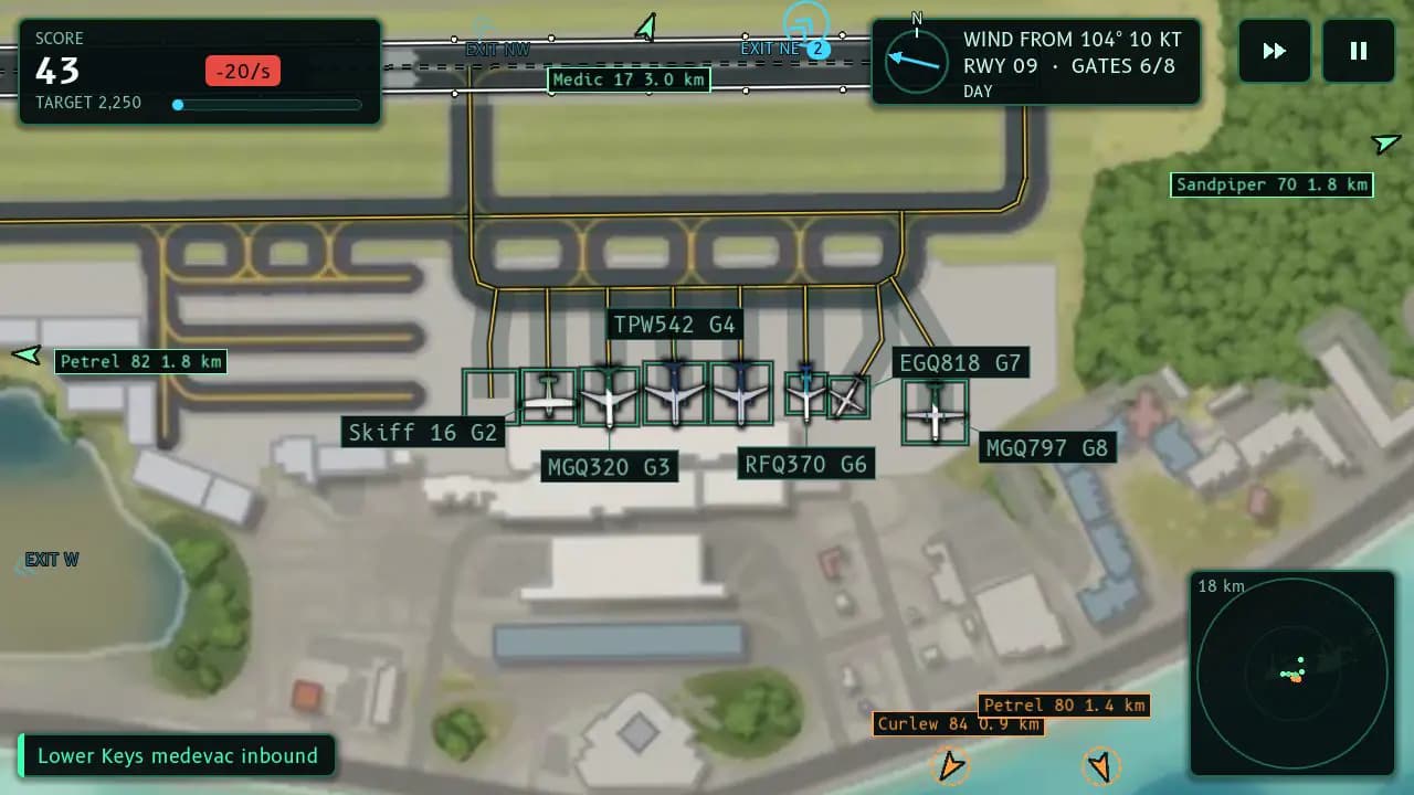
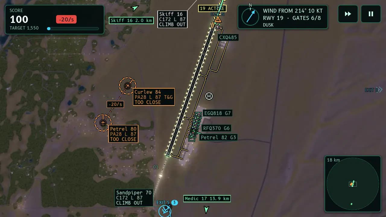
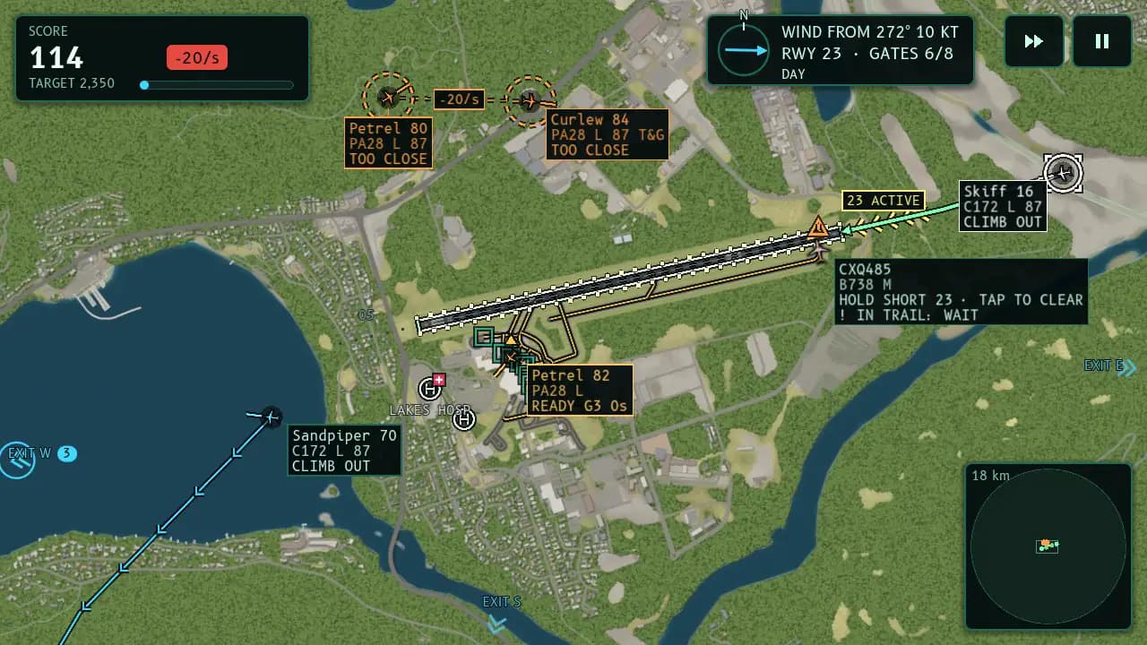
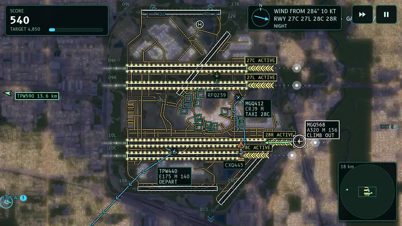
Arrivals appear at the edge of the map. Tap one and draw its path to the end of the active runway. Departures wait at the gates for you to draw them out to the runway and away. Keep everyone apart, keep the gates turning, and keep the score climbing.
Then the wind shifts. A new runway lights up, the old one goes dark, and everything already lined up has to be re-planned. A shift lasts as long as you can keep it safe, and the traffic and the weather build the longer it goes.
What's inside
One finger runs the tower
Tap an aircraft and draw its path to the runway. No altitude menus, no speed dials: just your finger, the map and the clock.
The wind calls the runway
When the wind shifts, a new runway lights up and the old one closes soon after. Read the lights and re-plan before your arrivals are lined up the wrong way.
Gates and departures
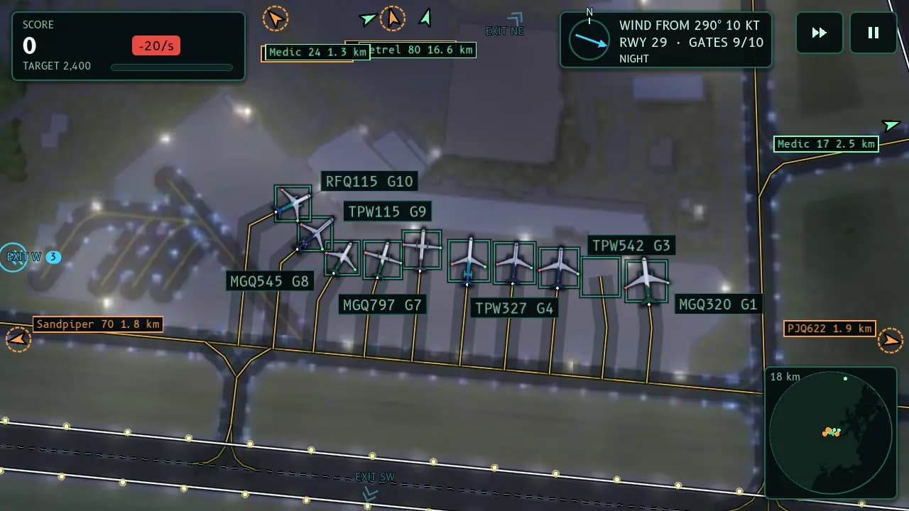
Landed aircraft taxi to a gate and turn around. Release them on time, because when every gate is full, the next arrival has to go around.
Real airports
Key West, Jackson Hole, Portland (Maine), Queenstown and Geneva, with their real runway layouts. Beat each airport's target score to unlock the next. Airport packs take the tower around the world in the next update.
Day, night and weather
Shifts start at any hour and the clock keeps turning through day, dusk and night, with rain, fog and snow where the airport's climate brings them. Emergencies and medical helicopters need you first.
Leaderboards for every airport
Climb the Monthly and All-time boards at each airport under a name you build from family-friendly word lists.
Good to know
- Free to play and supported by ads. Full-screen ads only appear between shifts, never during one, and after a crash you can choose to watch an ad to keep your shift going.
- A one-time Remove Ads purchase turns off the ads between shifts.
- No account is needed, and your progress stays on your device. Leaderboard names are picked from word lists, never typed, and players under 13 can view the boards without posting.
- Two map themes: painted Satellite and a dark Radar scope. The airlines are made up.
- Read how ATC Vectors handles your information in its privacy policy, or get help on the support page.
Map data © OpenStreetMap contributors (ODbL). Contains modified Copernicus Sentinel data 2023, 2024, 2025 and 2026. Elevation: Copernicus DEM GLO-30 © DLR e.V. 2010-2014 and © Airbus Defence and Space GmbH 2014-2018, provided under COPERNICUS by the European Union and ESA. Airport data: OurAirports (public domain).
Airport packs
The free game comes with five airports. Airport packs take your tower around the world: eight packs of ten real airports each, every airport open the moment the pack is yours.
Or take the World Tour: every pack, now and later, plus Remove Ads and Expert Approaches, ten famously hard approaches that come only with the World Tour.
Packs and the World Tour arrive in the next update of ATC Vectors as one-time purchases in the game's Store. Each pack's maps download the first time you open one of its airports.
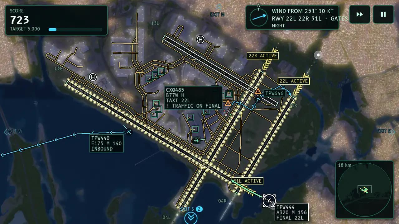
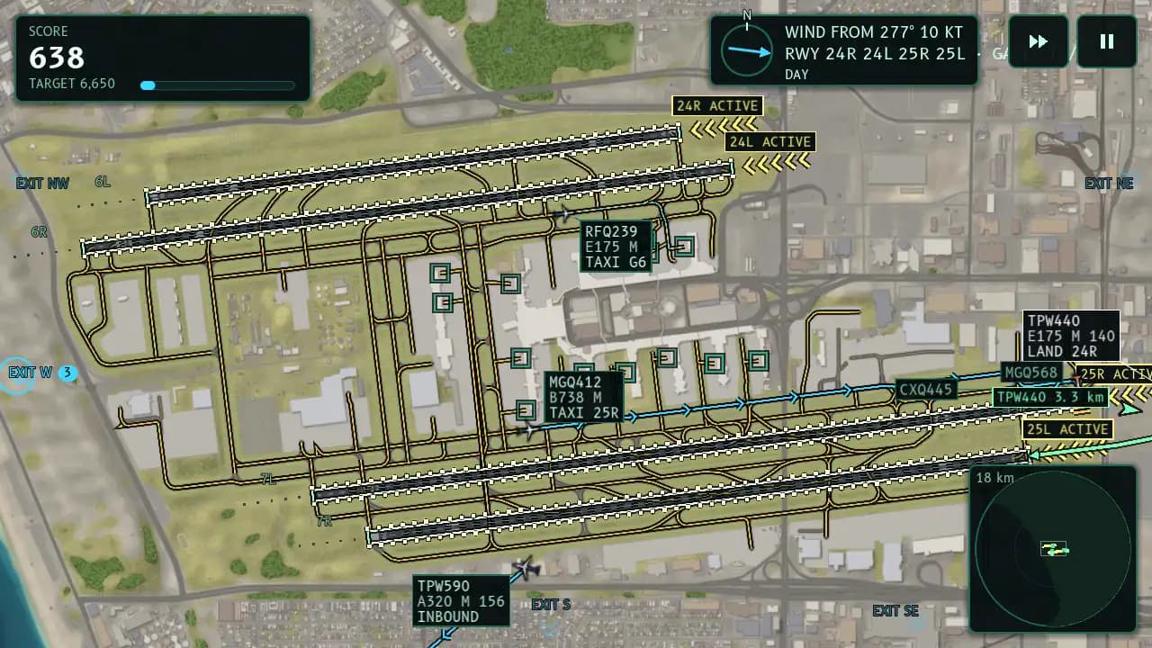
Pack 1Coast to Coast
Next updateUnited States and Canada
Run the busiest skies on Earth, from the Canarsie curve at JFK to Denver's pinwheel, then thread jets into Aspen's valley and Juneau's fjord.
Ten airports
- Aspen, Colorado ASEAspen-Pitkin County Airport (Sardy Field)
- Atlanta, Georgia ATLHartsfield-Jackson Atlanta International Airport
- Chicago, Illinois ORDChicago O'Hare International Airport
- Dallas-Fort Worth, Texas DFWDallas Fort Worth International Airport
- Denver, Colorado DENDenver International Airport
- Juneau, Alaska JNUJuneau International Airport
- Los Angeles, California LAXLos Angeles International Airport
- New Orleans, Louisiana MSYLouis Armstrong New Orleans International Airport
- New York, New York JFKJohn F. Kennedy International Airport
- Toronto, Ontario YYZToronto Pearson International Airport
Pack 2Tropics and Andes
Next updateLatin America and the Caribbean
Skim jets over Maho Beach, hook around Sugarloaf Mountain, and climb out of thin Andean air above Mexico City and Bogota.
Ten airports
- Bogota, Colombia BOGEl Dorado International Airport
- Buenos Aires, Argentina AEPAeroparque Jorge Newbery
- Cancun, Mexico CUNCancun International Airport
- Lima, Peru LIMJorge Chavez International Airport
- Mexico City, Mexico MEXMexico City Benito Juárez International Airport
- Panama City, Panama PTYTocumen International Airport
- Rio de Janeiro, Brazil SDUSantos Dumont Airport
- Santiago, Chile SCLArturo Merino Benitez International Airport
- São Paulo, Brazil GRUSão Paulo/Guarulhos–Governor André Franco Montoro International Airport
- Sint Maarten SXMPrincess Juliana International Airport
Pack 3Fog and Fjords
Next updateNorthern Europe
Work the holding stacks over London, untangle Schiphol's six runways, then fly the Alps' tightest valley and an Arctic fjord.
Ten airports
- Amsterdam, Netherlands AMSAmsterdam Airport Schiphol
- Copenhagen, Denmark CPHCopenhagen Airport, Kastrup
- Dublin, Ireland DUBDublin Airport
- Frankfurt, Germany FRAFrankfurt Airport
- Innsbruck, Austria INNInnsbruck Airport
- London, United Kingdom LHRLondon Heathrow Airport
- Munich, Germany MUCMunich Airport
- Oslo, Norway OSLOslo Airport, Gardermoen
- Paris, France CDGParis Charles de Gaulle Airport
- Tromsø, Norway TOSTromsø Airport, Langnes
Pack 4Sun, Sea and Volcanoes
Next updateSouthern Europe and Turkey
Beat Madeira's gusts, fly the volcanic coast of Lanzarote, and route the traffic around Mount Etna.
Ten airports
- Athens, Greece ATHAthens International Airport Eleftherios Venizelos
- Catania, Italy CTACatania-Fontanarossa Airport
- Funchal, Madeira, Portugal FNCCristiano Ronaldo International Airport
- Istanbul, Turkey ISTIstanbul Airport
- Lanzarote, Canary Islands, Spain ACECésar Manrique-Lanzarote Airport
- Lisbon, Portugal LISLisbon Humberto Delgado Airport
- Madrid, Spain MADAdolfo Suárez Madrid–Barajas Airport
- Palma de Mallorca, Spain PMIPalma de Mallorca Airport
- Rome, Italy FCORome–Fiumicino Leonardo da Vinci International Airport
- Venice, Italy VCEVenice Marco Polo Airport
Pack 5Desert and Safari
Next updateMiddle East and Africa
Run Dubai's round-the-clock rush, then bring jets in to Cairo, beside Nairobi's national park and onto the spice island of Zanzibar.
Ten airports
- Addis Ababa, Ethiopia ADDAddis Ababa Bole International Airport
- Cairo, Egypt CAICairo International Airport
- Cape Town, South Africa CPTCape Town International Airport
- Doha, Qatar DOHHamad International Airport
- Dubai, United Arab Emirates DXBDubai International Airport
- Johannesburg, South Africa JNBO. R. Tambo International Airport
- Mahé, Seychelles SEZSeychelles International Airport
- Marrakesh, Morocco RAKMarrakesh Menara Airport
- Nairobi, Kenya NBOJomo Kenyatta International Airport
- Zanzibar, Tanzania ZNZAbeid Amani Karume International Airport
Pack 6Monsoon Skies
Next updateSouth and Southeast Asia
Beat Delhi's winter fog and the monsoon storm cells over Singapore, Mumbai and Bangkok, then land jets on a coral island in the Maldives.
Ten airports
- Bangkok, Thailand BKKSuvarnabhumi Airport
- Denpasar, Bali, Indonesia DPSI Gusti Ngurah Rai International Airport
- Jakarta, Indonesia CGKSoekarno-Hatta International Airport
- Kuala Lumpur, Malaysia KULKuala Lumpur International Airport
- Malé, Maldives MLEVelana International Airport
- Manila, Philippines MNLNinoy Aquino International Airport
- Mumbai, India BOMChhatrapati Shivaji Maharaj International Airport
- New Delhi, India DELIndira Gandhi International Airport
- Phuket, Thailand HKTPhuket International Airport
- Singapore SINSingapore Changi Airport
Pack 7Typhoon Coast
Next updateEast Asia
Run four runways on Tokyo Bay, thread Hong Kong's mountains, and land on offshore runways at Macau and Nagasaki.
Ten airports
- Fukuoka, Japan FUKFukuoka Airport
- Hong Kong HKGHong Kong International Airport
- Jeju, South Korea CJUJeju International Airport
- Macau MFMMacau International Airport
- Nagasaki, Japan NGSNagasaki Airport
- Osaka, Japan KIXKansai International Airport
- Seoul, South Korea ICNIncheon International Airport
- Shanghai, China PVGShanghai Pudong International Airport
- Tokyo, Japan HNDTokyo Haneda International Airport
- Ulaanbaatar, Mongolia UBNChinggis Khaan International Airport
Pack 8Reef and Range
Next updateOceania and the Pacific
Fight Wellington's crosswinds, land on Tahiti's reef runway and ride Sydney's southerly busters, from the Coral Sea to the Southern Alps.
Ten airports
- Auckland, New Zealand AKLAuckland Airport
- Brisbane, Australia BNEBrisbane Airport
- Cairns, Australia CNSCairns Airport
- Christchurch, New Zealand CHCChristchurch International Airport
- Honolulu, Hawaii HNLDaniel K. Inouye International Airport
- Melbourne, Australia MELMelbourne Airport
- Papeete, Tahiti, French Polynesia PPTTahiti Faa'a International Airport
- Perth, Australia PERPerth Airport
- Sydney, Australia SYDSydney Kingsford Smith Airport
- Wellington, New Zealand WLGWellington International Airport
Pack 9Expert Approaches
Next update, World Tour onlyFamously hard approaches worldwide
Ten famously hard approaches: land uphill at Lukla, slalom down Paro's valley, wait for Gibraltar's runway crossing to clear and beat the tide at Barra.
Ten airports
- Courchevel, France CVFCourchevel Altiport
- Gibraltar GIBGibraltar International Airport
- Isle of Barra, Scotland BRRBarra Airport
- Kathmandu, Nepal KTMTribhuvan International Airport
- London, United Kingdom LCYLondon City Airport
- Lukla, Nepal LUATenzing-Hillary Airport
- Paro, Bhutan PBHParo International Airport
- Saba, Caribbean Netherlands SABJuancho E. Yrausquin Airport
- San Diego, California SANSan Diego International Airport
- Tegucigalpa, Honduras TGUToncontin International Airport